Posts Tagged ‘Interstate 81’

My wife and I rode our Harley Davidson Ultra Limited 898.9 miles in four and quarter days.  Our goal was to ride our motorcycle the entire length of the Back of the Dragon from Marion, Virginia to St. Marys West Virginia. The Back of the Dragon is also known as US Route 16 and is not “The Tail of the Dragon”. For the most part the roads were great, the weather was great and the time away from work was great.

Over the next few weeks I am going to break out each day’s ride.  Starting with this post and day of our mini motorcycle vacation.

DAY 1: Run like hell and get wet! Or Storm Chaser Powers Activate.

I get off work, according to the official schedule at 4:30 PM, often it is much later than that.  This day I shut down everything at exactly 4:30. Debbie had the motorcycle packed and ready to roll. At 4:50 we were on the bike and headed south to Marion.

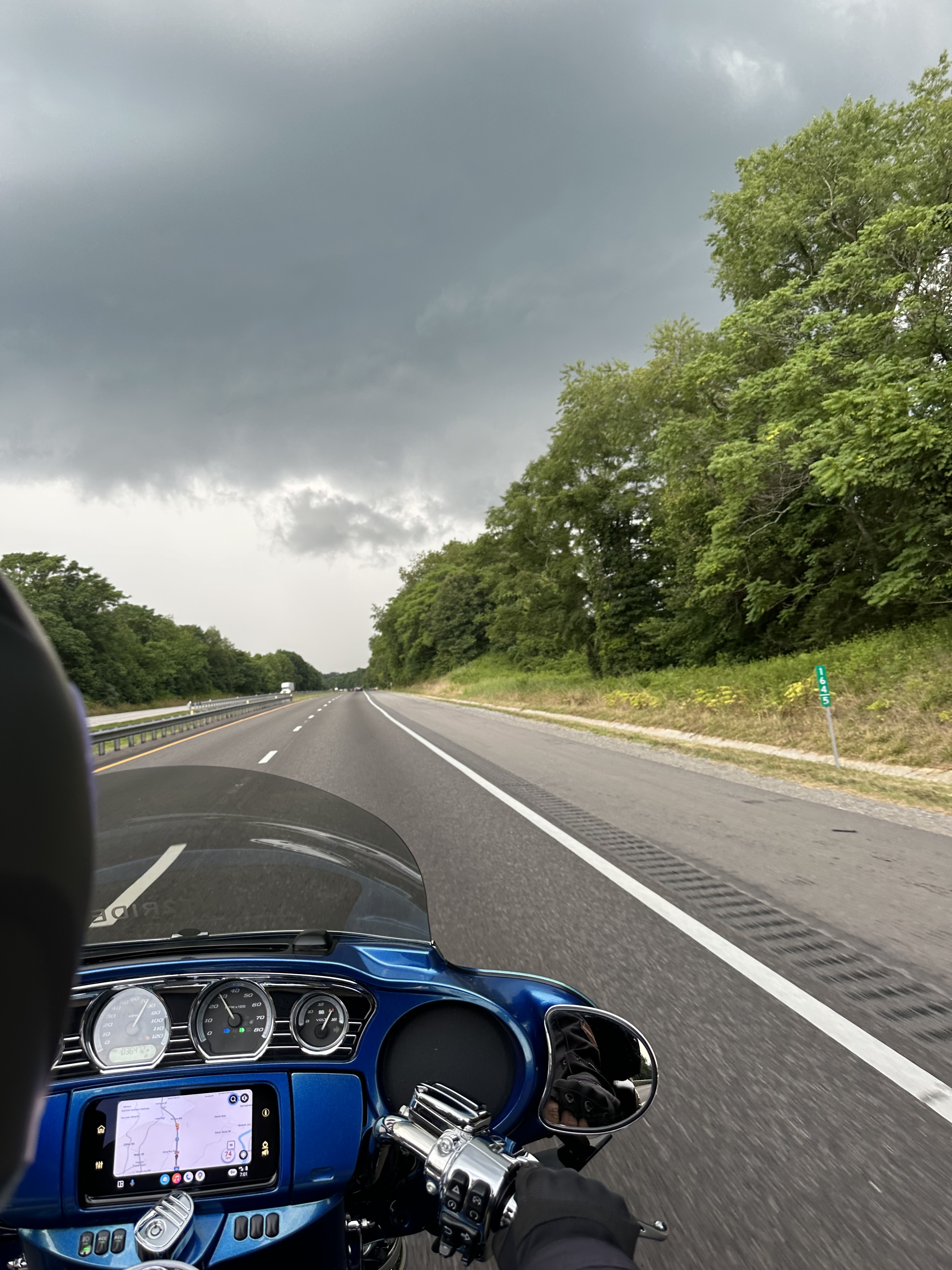
Unfortunately, to get to Marion from our home quickly we must use Interstate 81.  I81 is, in my opinion, a terrible road for motorcycles. Tractor trailers are consistently changing lanes to get around each other slowing traffic from 70 to 45 MPH.  The big truck were running three abreast on some parts of the highway.

The car traffic is no better. Drivers in the left lane running at or below the posted speed limit forcing people to sprint around them. Distracted drivers texting on their phone, which is even more madding when you know that particular automobile has hands free built in! You have to have your attention on the road 100% of the time and looking as far as ahead as possible.

Taking the above into account I was hoping to get to Marion in about four hours. That did not happen.

At about hour three, the clouds turned dark, then very dark, and then our Storm Chaser Powers were once again active and at full strength.  We left the highway at the next exit and parked under the awning of mom and pop gas station. 

We were only feet away from the awning when the full force of the storm hit. The rain was coming down so hard it was difficult to see the far side of the road. Lightning was striking within a mile of where we were sitting. The water in the parking lot rose so fast that within minutes it was lapping all around our tires.

Debbie was looking at the phone at both weather radar and nearby hotels. She spotted a break in the storm and a hotel six miles away. Mounting up, we started to move out when I noticed that the water between us and the road was about 18 inches deep.

I wish I had the camera on as we passed through the water, it looked like Moses parting the Red Sea!  Hitting I81 again I had to run carefully with flashers on.  We made it to the hotel with minutes to spare before the next wave of rain arrived.

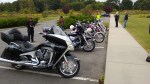
Luckly the hotel had clothes driers available which made the next day a lot more fun!  Also, this was the only rain we had for the entire weekend.

Next up – Day 2 Taming the Dragon

Last Saturday I rode with the Northern Virginia Motorcycle Club (NOVA MC) to the Route 11 Potato Chip factory.  Debbie had to work so she missed out on the fun.  WP_20130914_007

The start point was in Manassas, VA with a link up time of 8 AM but I left the house early in order to stop and have breakfast with Debbie.  We stopped at the Chick-fil-a in Leesburg to have a quick meal I then went to ride and she went off to work.

We had eleven bikes, several with passengers, show up for the ride.  After a short safety brief from the road captain “Chaz” we started to roll out…. But, one of the bikes had a malfunction, it would not start.  After a few attempts at “bump starting” it was apparent it was not going anywhere.  We confirmed that the rider had the issue covered and then set off.

It was a bit cool when we hit the road, around 60 degrees (Fahrenheit) and of course even cooler as we road down Interstate 66.  After the merge of I-66 and Interstate 81 we took the first exit (Route 11) and headed south.  We rode though the towns of Strasburg, Woodstock (where we noticed that the temperature was now around 55 degrees), Edinburg, and Mount Jackson.

Turns out that I-81 was the major interstate replacement for Route 11. 11 begins at the Canadian border at Rouses Point, NY and ends in Louisiana.  Route 11 is 1,645 miles or 2,647 KM in length.

Turning off Route 11 we hit Wissler Road (VA 720) and rode through Meems Bottom Covered Bridge.  The bridge was a bit tricky, it had raised wooden planks for cars to traverse, which caught me a bit off guard.  Going into a dark covered bridge with dark sun glasses trying to keep a good distance and pace while riding on raised planks….interesting!

A few miles from the covered bridge is the Route 11 Potato Chip factory.  It is out by itself, you have to want to go there, which we did.  They were not cooking chips that day but I have to admit that for a place that deep fries their product it was remarkably clean!  The owner gave us an overview of how the operation works which was interesting and we sampled all their different types of chips.

I liked the BBQ chips the most and bought a bag for myself.  I also bought a small bag of their “hot” chips, Mama Zuma’s!  Now that was a spicy potato chip!

After the visit to the chip plant we stopped for lunch at Johnny Appleseed’s restaurant.  The food was nice and the lunch conversation was better.  After we ate it was time to head back.  We took VA 340 North and I followed the same path as when Debbie and I visited New Market Battlefield (click here for that ride).

All in all it was another great ride with the NOVA MC!

The weather in Northern Virginia has not been conducive to riding motorcycles of late.  Today was the first day, in about the last ten, which I have had a chance to ride, and it was just commuting to work.  But hey, any day riding is a good day! 

One of things about becoming a good blogger, I have read, is that you need to post frequently. Due to the fact that we have not been “out and about” over the last few weeks I thought I would write about something related to riding.  

We collect bike related stick pins.  Mostly Harley Davidson Dealer Pins, but rally and event pins as well.  We have nearly 100 different pins so have I nearly 100 days’ worth of material to post/discuss, LOL. 

The pin displayed today is from Roanoke Valley HD near Roanoke, VA.  I stopped at this dealership (off Interstate 81) during a business trip to Oak Ridge, TN.  I don’t remember much about the shop itself but the pin is cool!

Image

This past weekend my wife and I rode from our home in Leesburg to the New Market Civil War Battlefield.  We rode west on US Route 7 then took Route 340 south to Luray, VA. On the way we passed the interesting roadside attraction of Dinosaur Land.  The place was not open when we stopped for a photo op but it looked very cool for small kids! Image

After posing a few minutes with T-Rex we contained south on 340 passing through rolling farm county and small towns of the Shenandoah Valley.  The largest town we passed through was Front Royal, which is also the northern entrance to Skyline Drive. We have done the Skyline Drive before but I am sure we will do it again this summer, it is just a too nice a ride not to do it as often as possible. (Route 340 south of Front Royal is also known as the Stonewall Jackson Memorial Highway to honor the Civil War General.)

Rolling past Front Royal we soon arrived in Luray, VA and our next intersection.  Taking Route 211 west we passed the entrance to Luray Caverns, a US National Landmark.  We did not stop at the caverns on this trip but I am sure we will sometime in the future.

Image

Crossing under I-81 on 211 we were immediately at the entrance to the Virginia Museum of the Civil War and New Market Battlefield.  From the website “The Virginia Museum of the Civil War (VMCW) interprets the 1864 Battle of New Market with emphasis on the role of Virginia Military Institute Cadets and the Civil War in Virginia.”  The museum was quite nice with small displays on most of the major engagements of the war which occurred in Virginia.  They also have a

A couple of hours later we hopped back on the bike and traced our route back north.  We deviated a bit by riding to Grove’s Harley Davidson in Winchester, VA.  We arrived at the dealership about 15 minutes from closing and did not stay too long.   I was hoping to look at their helmets as I am in the market for a new one.  30 minute video “The Field of Lost Shoes” that focused mainly on the boy soldiers of the Virginia Military Institute role in the battle.

Turing right out of the dealership we took US 50 east to State route 601 also called the “Secret Blue Ridge Mountain Northern Stretch”.  This is a twisty section of road that connects US 50 and US 7.  This is a great short ride and well worth the side trip.  The views from the mountain are limited by the forest but you should be concentrating on the road anyway, right!

Our trip was 166 miles round trip and lasted a bit more than 7 hours.  Debbie and I had a nice motorcycle ride together but we still need to figure out the intercom system!