Archive for the ‘Motorcycle Rides’ Category

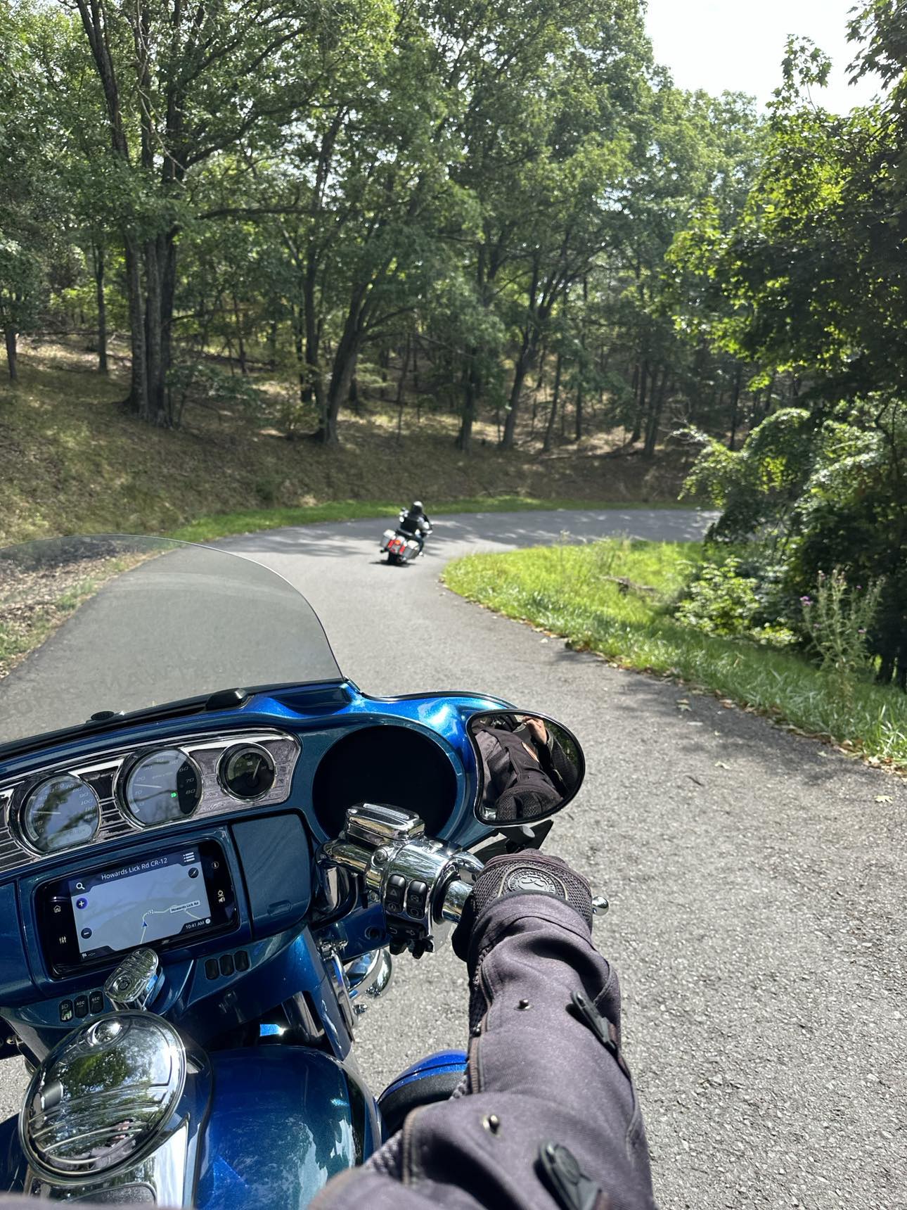
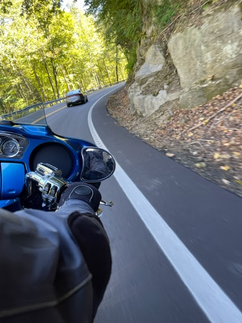
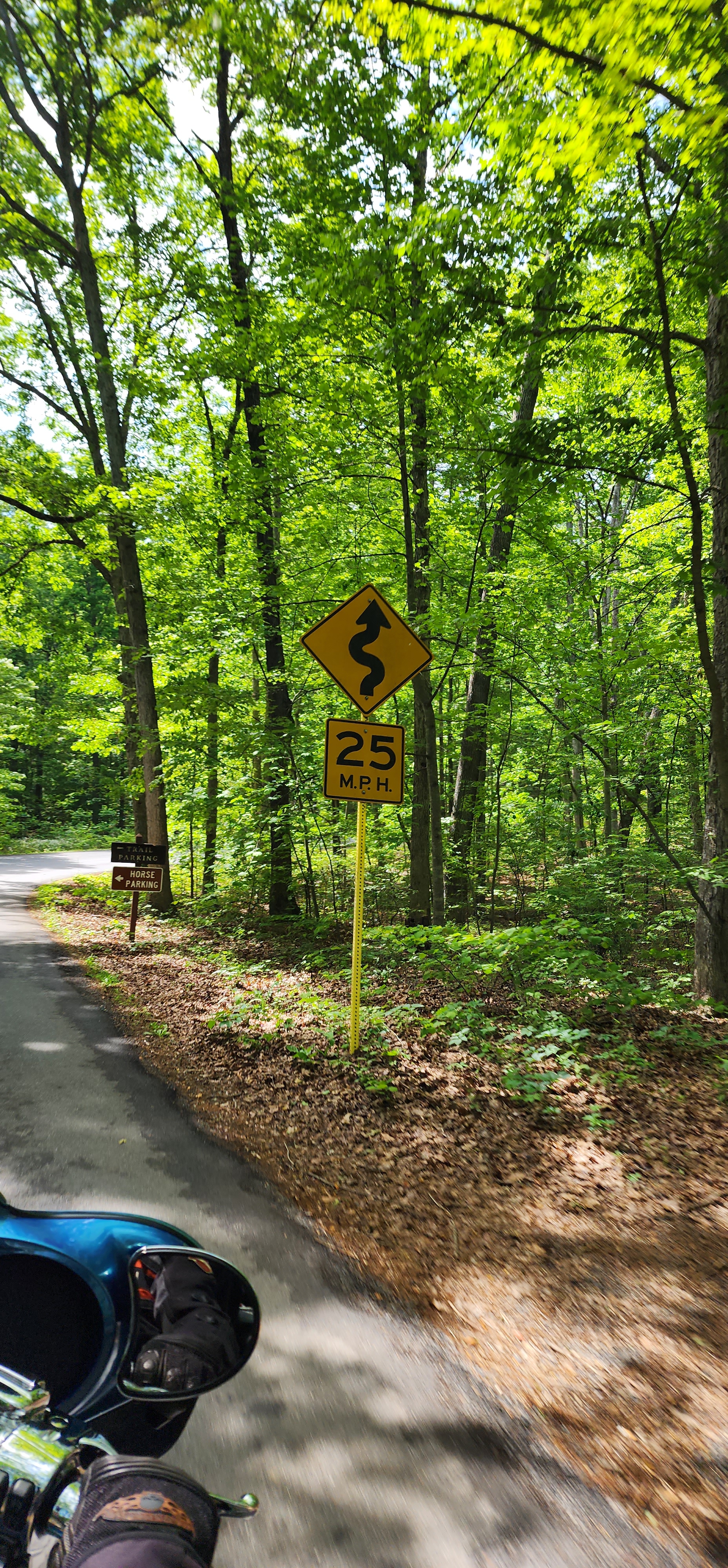
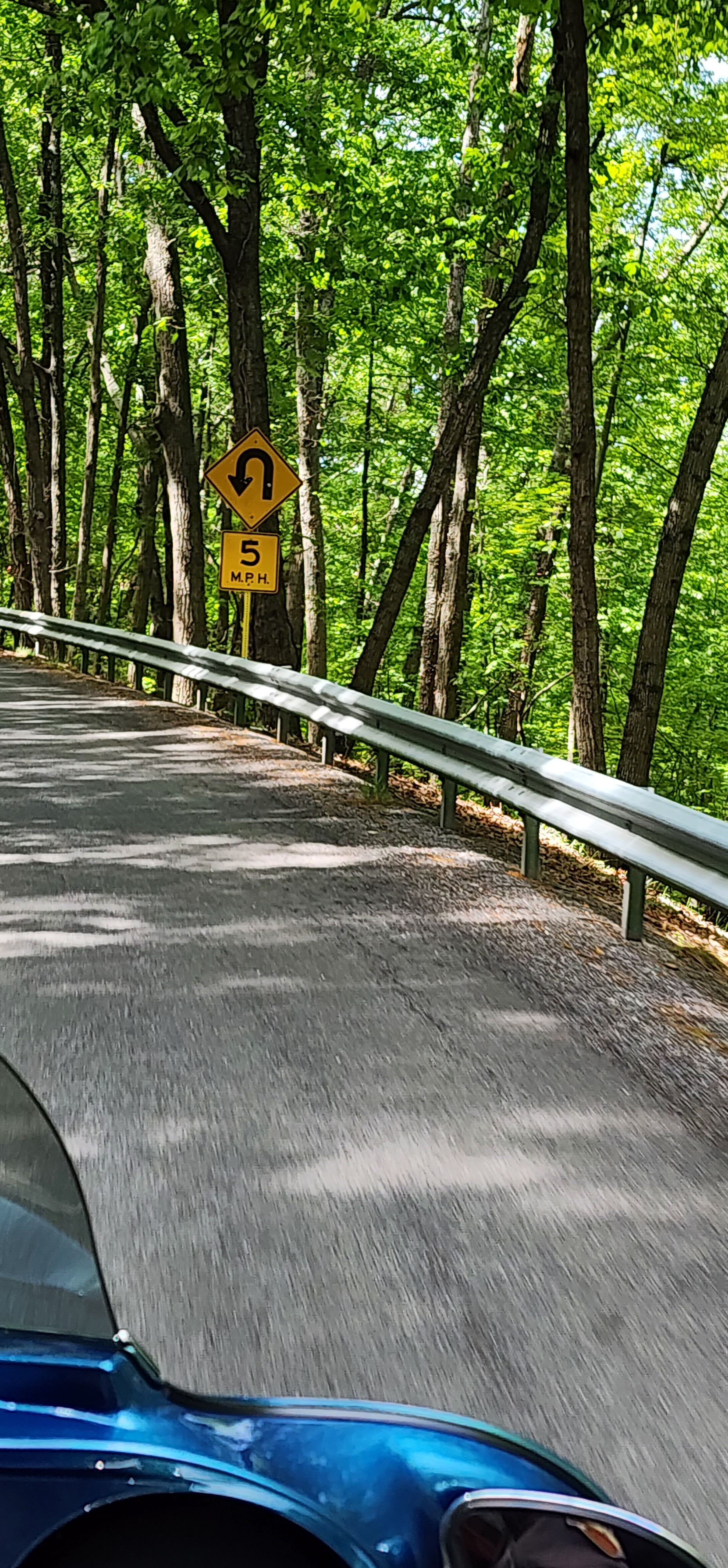
Howard’s Twisted Tongue is also known as Howard’s Lick, Lost River State Park Road, and West Virginia Route 12 this is a technically difficult road to ride your motorcycle. It is an unmarked 1 to 2 lane road with multiple 180 switchbacks and hairpins.

I had never heard of Howard’s Twisted Tongue until a few days before we made the ride.  My riding buddy, Mark, discovered this ride on a map, it was close by and looked like it might be fun, so it was time to mount up and ride.

The weather on the day we took off for Howard’s Twisted Tongue was perfect for riding motorcycles.  It was partly sunny and early morning cool.

It did not take long to get to the road, and we knew from the start that it was going to be a bit of a challenge as it became a steep incline immediately.  I don’t know how high we climbed but my best guess would be between 800 and 1000 feet.

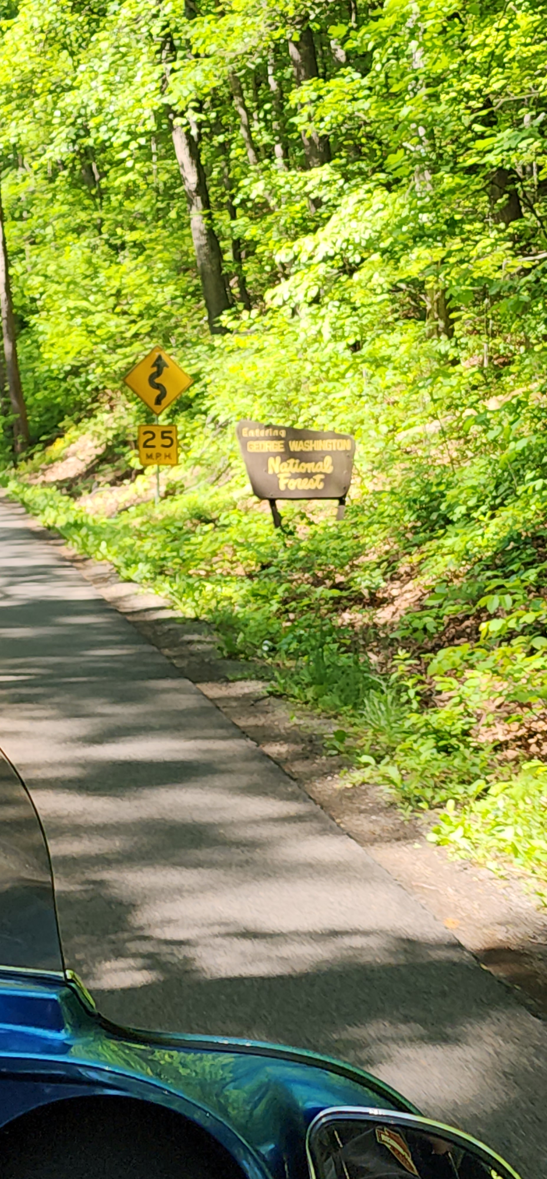
Did I mention multiple switchbacks and hairpins?  There are a bunch of tight turns, many are a little off camber, and most are ascending or descending steeply.  You need to watch yourself as many of these turns have gouges in the road from heavy vehicles or vehicles towing trailers. The road itself is, as I noted, unmarked, in mostly good condition but with some rough and potholed areas as well.

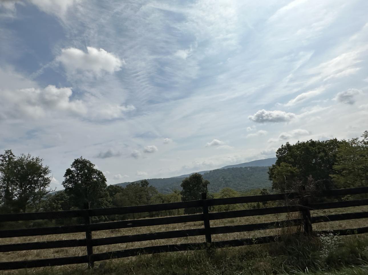
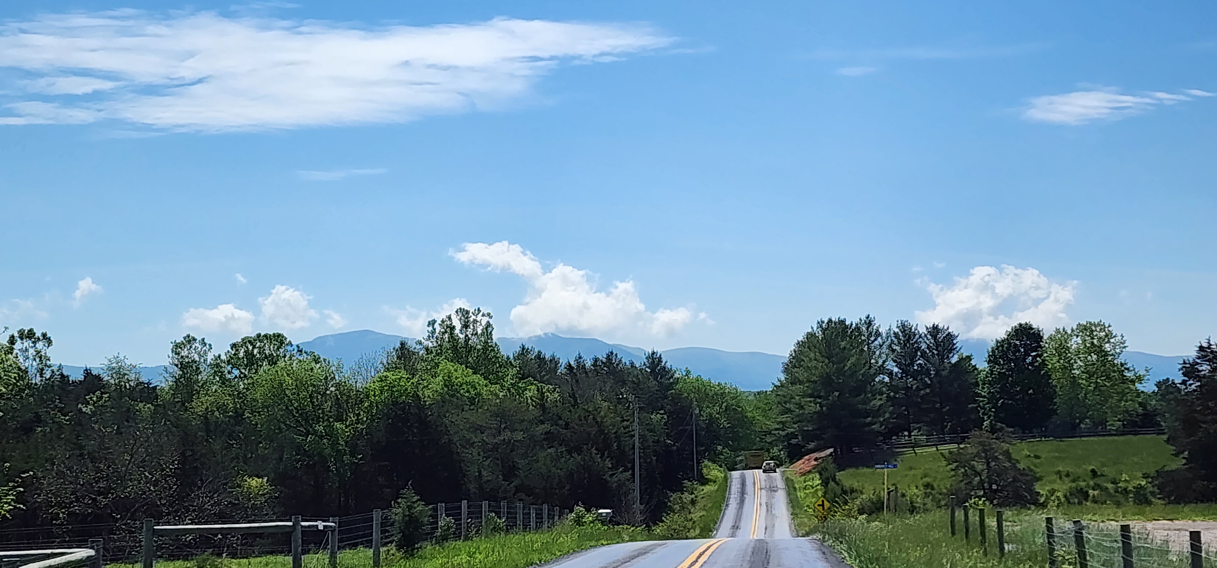
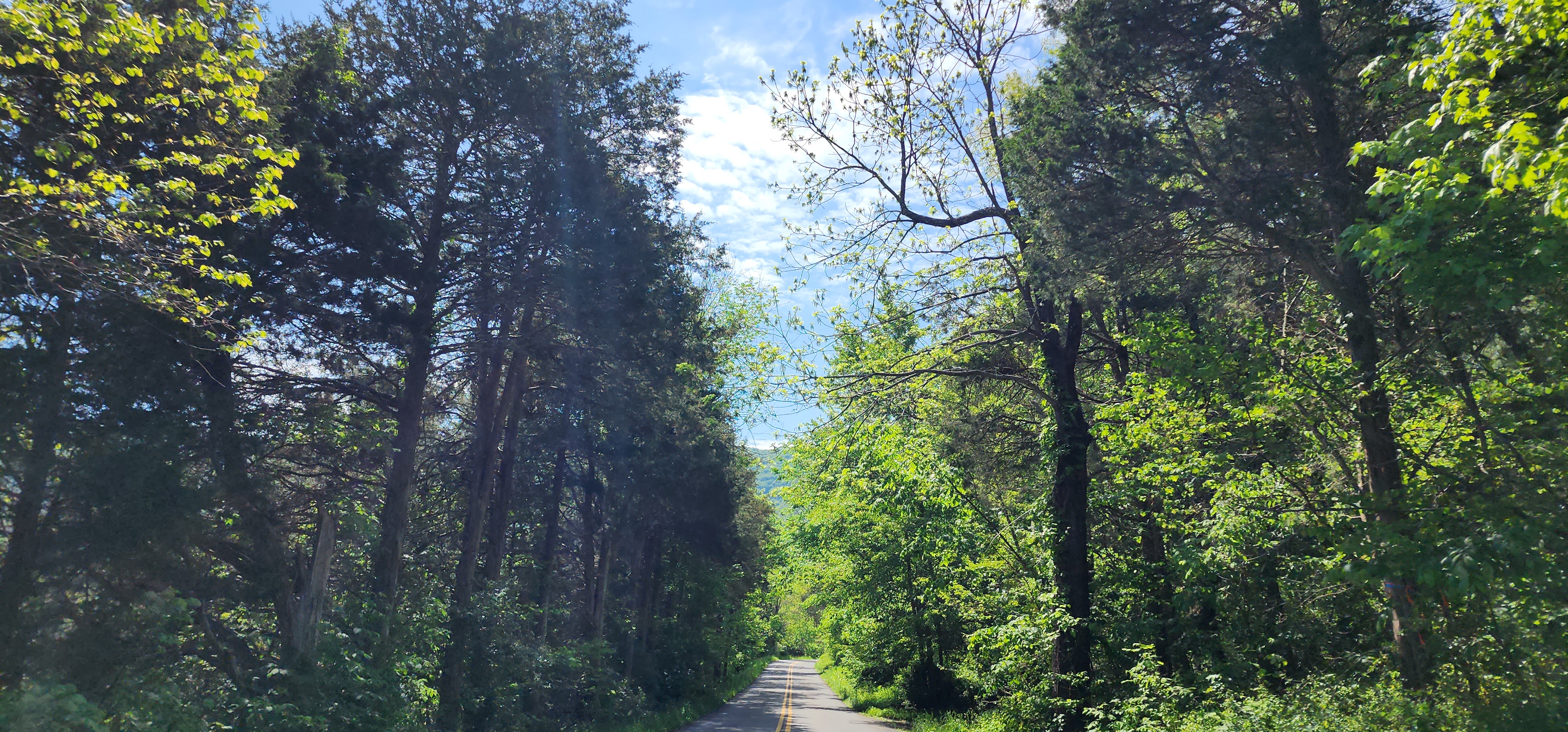
The climb up is well worth the ride, as you will ride along the ridge top for several miles.  The views from the top of the ridge are great and there are a surprising number of very expensive homes along the road.

After a few miles you will start the descent which will take you into Lost River State Park.  I have been to Lost River State Park in the past and I like to make the park a day ride destination.

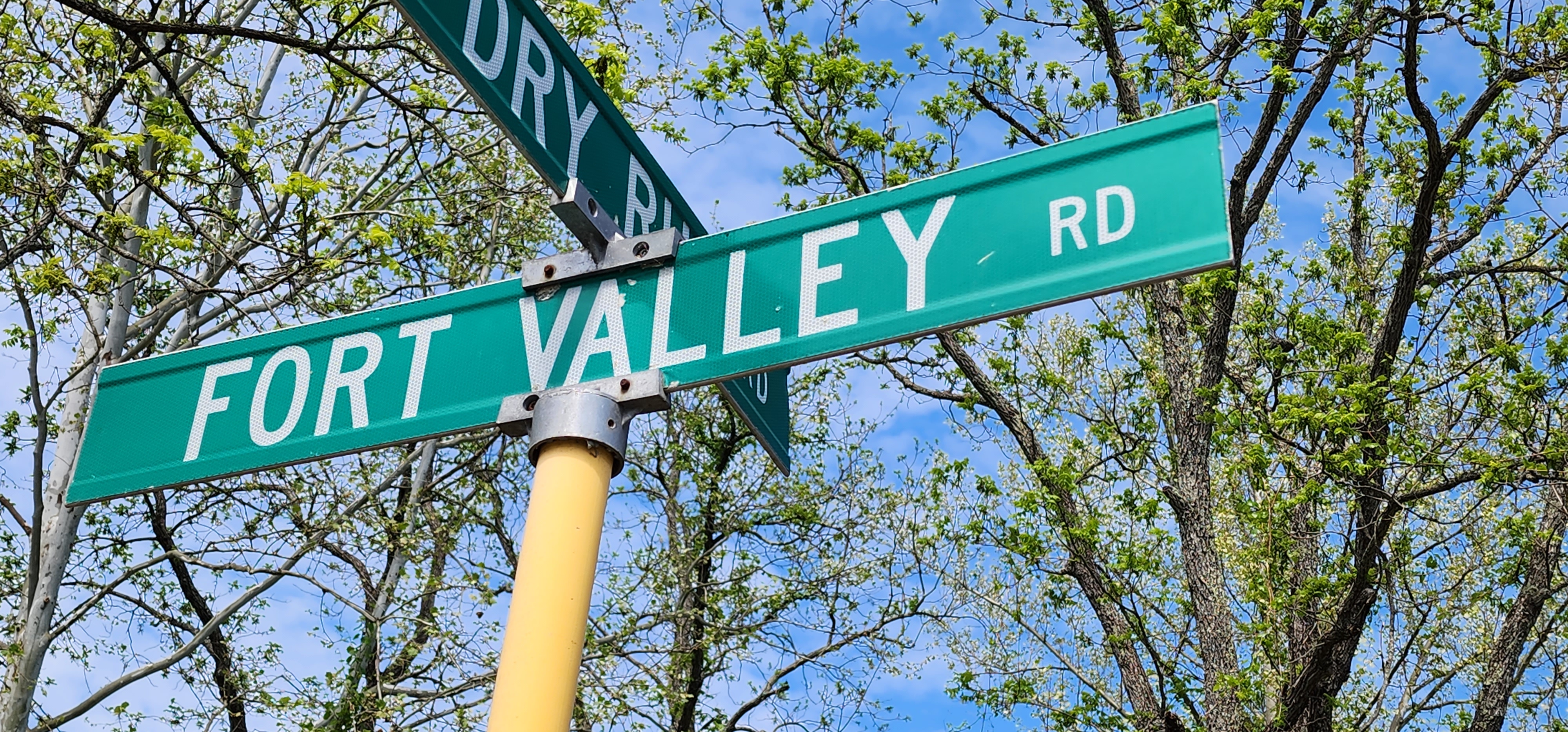
Howard’s twisted tongue ends, for us, at the intersection of 12 and 259 at the town of Mathias.  If you are going to ride this road, be ready for some technical riding.  You will be in low gear for a lot of time. Make sure you get your head turned and remember to “look where you want to go”.

*****

Ride on, Ride safe

We wake up early to get ready for the day’s ride, we are still an hour from Marion and the start of the Virginia side of the Back of the Dragon. Now mind you, it was not our choice to wake up this early. Our hotel “neighbors” kids were fully awake and running around and slamming their room door.

Happily, we now had dry clothes, the storm the day before soaked everything we were wearing. The standard hotel “continental” breakfast filled our stomachs enough to get us on the motorcycle and down the road.

Getting to the start of US Route 16, which is the Back of the Dragon was easy enough and quickly we were riding the Dragon. Passing Hungry Mother State Park, we begin to climb into the mountain and start the twisties.

What a great ride!  It was a cool morning, blue sunny skies with puff clouds, and the Harley Davidson motorcycle was running well. I was using our Go Pro and I thought my limited Go Pro skills had the camera working properly (turns out it kinda was and kinda not, I REALLY, need to read directions). It will be a while before I can edit and publish the video, not my strong suit.

We made a stop at what is called the “Back of the Dragon Lookout”.  With the clear skies we could see 3 distant ridges along with some valley farmlands.  A very nice view and you should stop to check it out if you ride the dragon.

The road was a great treat for those that love twists and turns.  As we were riding in the early-ish morning there was little traffic. The only hazard was a dead deer that straddled both lanes. Riding through sections of the road titled “Cliff Hanger”, “Zero Gravity”, “Knee Dragger”, and the “Roller coaster” got us to what is called “Million Dollar View and Kudzu Corner.

Kudzu Corner is about two thirds of the way through the Back of the Dragon and that last third is just as exciting as the rest.  I can highly recommend that you try out the 32 miles, 438 curves and the 3500 feet of elevation as it is just as fun as the Tail of the Dragon in Tennessee.

 At the north end of the route, in Tazwell, VA, there is a Back of the Dragon shop catering to both motorcycle and car enthusiasts who come to make the ride.  A very nice setup with shirts/pins/patches and all the other things that we like to collect.  The building also has a brewery, coffee shop and food trucks (the food was good). There is also a photo op with a very big dragon!

After the visit to Tazwell, we set off north on US16 to explore the rest of the Back of Dragon.  This part of the Dragon was just as much fun to ride as the part we just left.  Passing the Virginia, West Virginia boarder we were shortly not only on the Back of the Dragon we were also on the Coal Heritage Trail which is an American Byway

The Coal Heritage Trail was also on my bucket list, so I was able to knock out both!  We passed through the coal towns of War, Welch, Pineville, Sofia, and many others.  Sadly, many of these towns have seen better days now that coal is being phased out.

When you reach Beckley, WV Route 16 will be a mix of 2 lane and 4 lanes for about 20 miles, you will need to pay attention to the intersections to make sure you stay on route as much as possible. When you reach the town of Fayetteville you will be back on a 2-lane road, and you will drop down into the New River Gorge.

When you reach Beckley, WV Route 16 will be a mix of 2 lane and 4 lanes for about 20 miles, you will need to pay attention to the intersections to make sure you stay on route as much as possible. When you reach the town of Fayetteville you will be back on a 2-lane road, and you will drop down into the New River Gorge. 

Climbing out of the Gorge you will face some of the best twists and turns of West Virgina side of the dragon.  Part of this road is also called the Talon, an 8-mile ride from the town of Ansted and Gauley Bridge. This should be a great side trip for anyone riding the Back of the Dragon that will not cost you much time. 

Ansted is where we stopped for the night.

Next up – Day 3 Taming the Dragon

One of the best driving and riding roads in the United States is Ohio State Road 555, better known as the “Triple Nickle”. This is not just my opinion it is also from Car and Drive and many other publications. Also 555 is also one of the Ohio “Windy9” roads and is heavily promoted, by the state, in many motorcycle publications.

Well, the Triple Nickle use to be a great motorcycle riding anyway!

Starting at the southern terminus of the road the road Ohio has “repaired” by the “Chipseal” method (or Tar and Chip where I grew up).  SR 555 is a ROYAL MESS.  I cannot recommend you ride a motorcycle on this road at this time, maybe in a year?

Gravel chips are everywhere.  Tight turns, and this road has many, can be dangerous along with every driveway and intersection.  When it gets hot the tar may become slippery if the chips have been removed by traffic or weather.

I don’t know how far north the chipseal goes as we turned off after about 10 miles. State Route 555 is just unsafe for motorcycles.

So, to answer the question, “How do you ruin a great motorcycle riding road?”  Just chipseal it, you could ruin it for years!

*****

Ride on, Ride safe

Michelin and Continental are two brands of tires I have never used, so I don’t have an opinion on there products. But with an $80 rebate now might be a good time give Michelin a shot.

Get a $80 Visa Reward Card via mail-in rebate with the purchase of two (front and rear) qualifying MICHELIN Cruiser Motorcycle tires.

Get a $60 Visa Reward Card via mail-in rebate with the purchase of two (front and rear) other qualifying MICHELIN On-Road and Road Racing Motorcycle tires.

Get a $40 Visa Reward Card via mail-in rebate with the purchase of two (front and rear) qualifying MICHELIN Off-Road Motorcycle tires or qualifying MICHELIN Bicycle tires.

If you need new tires, or shortly will, you might want to take advantage of this deal!

You can check out their range of motorcycle tires on their motorcycle website,

There are a lot of great locations, around the globe, that pull a lot of motorcycles to a town.  But what makes a town motorcycle friendly? I am discounting rallies like Sturgis or Daytona as those are all onto their selves and not, necessarily, indicative of being “motorcycle friendly town”.

I asked myself this question on what it takes to be motorcycle friendly and came up with the following items:

A town that provides motorcycle parking in public spaces.

A town that has good signage so folks will know where to go in town.

                    Signage that states motorcyclists are welcome.

                   Maybe a few “Watch for Motorcycle” signs too.

A town that provides maps, GPS files of local riding opportunities.

A town that has places where we can take cool pictures with our bikes.

That the town websites that indicates the town is pro motorcycle.

That the town supports motorcycle events like shows and rallies.

Then I asked myself, “Self what makes local businesses motorcycle friendly?”. Because how can the town be motorcycle friendly if the businesses are not? Business can be motorcycle friendly by:

          Providing motorcycle parking, covered if possible.

          Has good signage indicating that bikers are welcome.

          Has places where we can store helmets/gear while eating or shopping.

          Provides rider discounts.

          Just be friendly to motorcyclists, ask them what they ride, where they are headed.

          Provide maps, GPS files of local riding opportunities.

Website that indicates the business is pro motorcycle.

          Lodging business should, if possible, provide a place to clean the motorcycles along with a hose, bucket, soap, and towels

Those are the ideas that popped into my head.  Do you have any additional thoughts or suggestions?

Front Royal is set at the northern end of Skyline Drive, one of the premier motorcycling destinations on the east coast.  Thousands of motorcyclists pass through Front Royal on their way to Skyline Drive or to parts unknown as they leave the National Park.  At most they spend a night in town before heading on their way.

However, riders should spend a day or two riding in the Front Royal area. There are more than a few great riding roads and routes that will appeal to every motorcycle rider. Adventure bikers, you can check out the availability of roads in the George Washington National Forest as some become open to motorcycles, there is even a Jeep “Trail of Honor” that will put your skills to the test.

Fort Valley was first surveyed by George Washington in 1748. Washington would later make plans for Fort Valley to be his winter retreat, had the revolutionary army been defeated, as it has a lot of natural defensive features.

Between the Revolutionary War and the Civil War, the valley was a major source of pig iron for the new nation. During the Civil War the mountains surrounding the valley served as observation posts for the Confederate Army, overlooking multiple local battles.

Canyon Carving and Valley Riding

One of the best kept “secret” motorcycle riding roads around Front Royal is Fort Valley Road. A ride that is part canyon carving and relaxing valley riding. The ride will take about 2-3 hours, depending on how often you stop to take pictures or visit some of the local attractions along the way.

Once you turn onto Fort Valley Road it is just a few minutes before you are whipping your motorcycle through a tight canyon.  Rock wall cliffs on one side and a sharp drop into creek on the other will keep your attention very tightly focused.  After a while, that canyon passage will open into a farming valley.

You will ride for miles through a mix of green and amber fields intermixed with forest treescapes. This is the part of the ride that will have you sitting back and admiring the views of the steep mountains to your left and right and the family farms you motorcycle through.

But before long you are at the southern end of the valley where you will encounter an unmarked section of the road.  This part of Fort Valley Road is a steep climb out of the valley through twists and tight hairpin curves. As soon as you crest the top of the mountain you will begin a just as steep drop to the bottom of the mountain.  The views of the Shenandoah Valley as you descend can be quite awesome.

Once at the bottom you will leave Fort Valley Road and make your way back to Front Royal via US 340.  You will find that when you get back you just might want to do this loop a second time.

Local Highlights along the ride:

Front Royal Visitors Center

George Washington National Forest

Fort Valley Museum (open irregularly)

Skyline Caverns

The route:

From the Front Royal Visitors Center

Right on Main Street

Right on Royal Street = US 55 and 340

Left on Quadrant Road = US 55 (as you cross the bridge)

Left on Strasburg Road = US 55

Left on Fort Valley Road = VA 678

Straight on Fort Valley Road / Camp Roosevelt Road = VA 675

Left on North Egypt Bend Road = VA 684

Right on Bixlers Ferry Road = VA 675

Left on North Broad Street = US 340

Right on Main Street Front Royal

Day two started out bright and sunny with a heavy dew.  We had our motorcycle seat cover on so our butts would be dry in the seats, and the dew made it easy to wipe away the many bugs splats from the previous day! Today’s ride was a guided ride to “The Tail of the Dragon”, “Cherohala Skyway” and “Maple Springs Overlook”.

We lined up early at Smokey Mountain Harley Davidson, the staging area for all the guided motorcycle rides.  Our group ended up with 13 Harley Davidsons and 1 Indian. The Indian was ridden by a man who had come from Frankfort, Germany to attend the rally which was the longest trip to get to the rally. The Indian was what was available for rent when arrived. His Indian was not the only out of place bike at the rally, there were several Gold Wings interspaced throughout the event as well as a BMW.

Soon enough we were on the road passing through the quaint town of Maryville on our way to the mountains.  Things were going well until we realized that the number 5 motorcycle, we were the sixth, in line was ridden by Mr. Slow.  The moment we started into the foothills we fell behind quickly.  I was worried that we would miss a turn and go astray. Luckily, we had experienced group riders in front of Mr. Slow and they would stop at the turns to make sure we followed the correct path.

When we hit The Dragon, it was clear we were going to set a record for the slowest run of all times.  Mr. Slow rarely passed 20 MPH at anywhere along The Dragon.  Now, do not get me wrong, I really believe in the adage “Ride your own ride.” however you do not need to force more then half the group to ride your ride.  Mr. Slow had multiple places to pull off to allow the rest of us to proceed, we all knew we were going to stop at Deals Gap, NC to regroup.

At Deals Gap not only did we regroup we had a chance for a group photo and time to pick up some Dragon souvenirs. But we were shortly remounted on our iron horses headed for some additional twistiness and river front rides. This time I was in front of Mr. Slow.

By now we had been riding for 3 hours and the ride captain pulled off at Tapoco Lodge for lunch.  The lodge restaurant is perched along a creek with a view of mountains and road upon which we arrived for our meal. For atmosphere alone I would recommend a meal stop at the lodge. The food was good, but company and conversation were much better.

The Parking area at the Maple Spring Overlook

Back on the road we headed to Maple Springs Overlook. A two-lane road takes you up hill to a parking area 3300 feet above sea level. A short walk from the parked motorcycles gave us a spectacular view of valley below and the Smokey Mountains in the distance.  Turns out that this road was to be the start of the Cherohala Skyway but, plans changed and now we have a road to a wonderful overlook with an awesome view.

Speaking of the Skyway that was the next leg of our all-day motorcycle tour. The Cherohala Skyway is a National Scenic Byway running 41 miles from Tellico Plains to Robbinsville climbing to over 5400 feet above sea level. 

I think the plan was to make a couple stops along the Skyway, but we were behind schedule. Dinner and a concert were on tap for the evening. But even without the stop to admire the views it was, none the less, awe inspiring from the seat of a moving motorcycle.

When we returned to dealership, we went to dinner with another couple we rode with and then returned back to Smokey Mountain Harley Davidson for the Def Leppard cover band.

Still watching you Hurricane Ian but, it is not looking good! Sigh!

Ride On, Ride Safe

We rode for about 7 hours on Monday from our home to the rally. This ride was all interstate and really reminded me why one should avoid Interstate 81, south or north, it is a terrible experience in the best of times.  Thousands of tractor trailers and stupid car drivers weaving to get “the fastest” spot while hold a phone to their face.  SIGH.

As we approached the hosting hotel, the “Airport” Hilton, the GPS lady was telling us to ride the motorcycle to the arrivals and departures section of the airport. Of course, we thought that the crazy GPS lady was once again full of “stuff”, so I stopped and reselected the location.  Turns out the hotel is literally a few steps from the arrivals and departures doors of the airport.  Imagine that!

Day One of the Great Smokey Mountains HOG Rally

Rally registration was at the hotel and sign in for the pre-registered, like Debbie and me, was quick and easy.  We each received a SWAG bag that contain pertinent rally materials a t-shirt, patches, pins, and a HOG water bottle.

We were also showed how to download the routes from by scanning a Q-code from their routes posters and how to load those routes into the motorcycle. Snip/snap and we had multi-routes installed on our Harley Davidson. 

Ok not quite snip/snap.  The problem is the that the Harley Davidson Boom GTS radio/navigation system does not come with a paper owner’s manual but with a little coaching I was able to get the routes set up.  I mentioned to the National HOG representative that they should hold a few classes on using the Boom GTS at each rally, I think it would be one of the more popular aspects of future events.

After registration we rode to Smokey Mountain Harley Davidson. SMHD is the host dealership of the rally, and their facilities are among the best that I have ever experienced. A large dealership with an inviting exterior and expansive interior they have very large inventory of motorcycles (and sold 2 while I was there), accessories, and clothing.  But that is just the start, Smokey Mountain HD also has a BBQ restaurant and a concert venue. I have never seen a dealership like this before.  A little more on the concert venue below.

As we were looking around the dealership and the vendor, Debbie spotted a Custom Dynamics Rear Finder Tip Light which would be SO much brighter than the existing OEM light.  She bought the light and wanted it installed while we were there, I did not argue. With the large number of drivers, she saw holding phones on the ride down another run/brake light will never hurt.  I will do a separate post on this light and my thoughts on Custom Dynamics soon.

After the part was installed, we decided to ride through Wears Valley, TN.  The twisty ride up and over a mountain was a lot of fun and the ride through the valley was quite beautiful. The route we took dropped us in Pigeon Forge, TN near the Rocky Top Harley Davidson Dealership.  If you have followed IJustWant2Ride on Facebook or Twitter you will know I collect dealer pins which means I had to get a Rock Top pin!

We had a snack at the Iron Boar bar and Mexican Grill right across the street from the dealership … along with 30 new friends, all from the HOG rally! After we had fueled ourselves, we headed back to SMHD for the opening ceremony and the first concert of the rally.

Still watching you Hurricane Ian!

Ijustwant2ride.com

For a pleasant change we had family come to visit and ride with us! Debbie’s sister (Vicki) and her husband (Jeff) trailered their Harley Davidson Fat Boy motorcycle from Ohio to our home in Front Royal, VA.  Neither of them had ridden Skyline Drive or anywhere in this part of Virginia.

They came out for the Labor Day weekend arriving late Friday afternoon. Saturday morning, we unload their Fat Boy and made ready for Skyline Drive. The morning was cool but comfortable and the view of Skyline Drive from my driveway was clear and bright.  Little did we know that the bright sun would disappear and reappear and disappear and reappear as rode along the ridges of the parkway.

Stopping at a few of the early western view overlooks Vicki and Jeff though the sites of blue skies and the Shenandoah Valley were just spectacular! They were both enjoying the smooth tarmac and twisty nature of the parkway and as it was early in the day the bonus of a low traffic.

Looking east, however, I realized that the bright and sunny would not be the way the entire trip.  Lots of clouds clung at the treetops, with breezes moving them around in movie like motions as they sweep up and down the eastern ridge. I knew, from the number of times I have ridden the parkway, that in short order we would be riding in a cloud and the temps would drop.

I was not wrong, as we approached the first exit from Skyline Drive, Thornton Gap, the clouds were right down on the parkway.  Ridding through a cloud, if you have not done so, is foggy and damp.  Riding our motorcycles out of Thornton Gap we quickly made it to Mary’s Rock Tunnel.  Of course, we had to hit the throttle to hear the music of the V-Twins reverberate from the halls of the tunnel.

We pulled off at the Mary’s Rock overlook, today’s view was more, inside of cloud, then amazing vista but, we talked to Jeff and Vicki and generally admired Skyline Drive and the other motorcycles parked at the overlook.

Back on the bikes we were in and out the clouds going from warm to cool with the occasional mist and rain drops. We dropped off Skyline Drive at the second exit and then rode the motorcycles north on SR 340 back to Ft. Royal.

After the ride we went to “Shenandoah Valley Ax Throwing Company” for dinner and some fun.  Throwing the ax was a lot of fun and a bit therapeutic depending on what you were imagining the target to be 😊.  This is the first time we had been there be it will not be the last! 

The next day was just as much fun.  We rode the motorcycle south on Fort Valley Road to Luray.  Swung by Cooters, Duke’s of Hazzard Museum and then over Thornton Gap.

Thornton’s Gap has signs on both sides that state that this is a high crash area for motorcycles! The signs are right, people overestimate their skills.

Like the day before, as we reached the top of the ridge and passed under Skyline Drive, we activated our “storm chasers” superpowers. Three quarters of the way up a nearly all the way down the other side it was motorcycling in a light rain and fog.  But it was warm and sunny when we were back in the valley below.

This day we stopped for lunch in Front Royal at “PaveMint Smokn’ Tap House” which is a great place for wood smoked meals.  Everyone loved their food, Vicky and Jeff said they would like to come back someday. 

2 days of motorcycling, with 2 members of our family for 220 miles of the best of riding in Virginia … just cannot beat that!

Ride On, Ride Safe

I have ridden along many national parkways including the Natchez Trace (TN/MS), Great Lake Seaway Byway (NY), Blue Ridge Parkway (VA, NC) and, of course, the Skyline Drive Parkway (VA). I have also attended multiple motorcycle rallies along the east coast including Daytona.

Outside of rallies, I have never seen as many motorcycles in one location as I do in Front Royal, Virginia. During motorcycle riding season, it is not uncommon to see hundreds of motorcycles in Front Royal, either singular or riding in large groups daily. You can see these large numbers of motorcycles passing through almost every day but especially on weekends. In my opinion Front Royal could be the motorcycle destination of Virgina much like Tail of the Dragon in Tennessee.

Why are so many motorcycles passing through Front Royal? It is because the town is located at the northern terminus of Skyline Drive and about an hour from the nation’s capital.  All these motorcycle riders are passing through the town on the way to Skyline Drive or to parts unknown as they leave the Parkway.

By just passing through Front Royal motorcyclists are missing out on opportunities for some great local rides and the great local flavor.  For example, a rider can take a loop from Front Royal to Luray via Fort Valley Road. That ride would last about two+ hours, depending on stops, and would have you back in town by lunch time.

After lunch, mount the motorcycle and head south out of town to cross under Skyline Drive at it two gaps.  But be careful, they are quite technical, and the northern gap is designated as a high crash area. Two+ hours later you will be back in town with enough time to get to dinner and a stroll along main street.

After dinner, riders could visit the Virginia Beer Museum for brew and live music or Shenandoah Valley Axe Throwing for a unique activity or any of the many other venues in town.  Front Royal has lots of hotels and restaurants and a main street that could be considered a throw-back to another era. Check out the movie theater that has a 1950’s vibe with a state-of-the-art projector and sound system.

Front Royal may be the gateway to Skyline Drive, but it should also be a destination at the start or end of your motorcycle ride.  Stay a day or two, there are plenty of hotels and campgrounds, to explore both our local roads and our small-town atmosphere.