Posts Tagged ‘C&O Canal’

ijustwant2ride.com

Ferry Hill Plantation

Location – Ferry Hill Plantation

Mile Marker –72.8

Historical Comments – Just up the street from Lock 38 is the Ferry Hill Plantation. The area around the plantation began as a cross river ferry site in the 1760’s. The ferry and plantation remained in a single family’s hands until 1958, a really good run. It site served as a restaurant and bar until 1974, catering to the students from Shepherd College across the river in Shepherdstown, WV.

The plantation served as the headquarters of the C&O Canal National Park system from 1979 to 2001. Now it is a museum to the C&O Canal and plantation life in Maryland. If you are touring the Canal this is a nice side stop.

Ride to Site – At the intersection of Route 34 and Canal Road, the ride to the plantation is a smooth easy ride. Coming from Canal Road be aware of the traffic on Route 34 as the speed limit does not seem enforced.

Amenities – Visitors Center, public restrooms, parking

Road Conditions (from main road) – paved

Railway Situation – none

Parking Lot Conditions – Paved and pea gravel

Main Attraction – Ferry Hill Plantation.

My Thoughts – One of the hidden gems while motorcycle touring the canal (it happens to be air conditioned) 🙂 . The plantation house is manned my volunteer docents who provide an oral rendition of the history of the home and grounds.

Map

C&O Canal Motorcycle Ride: Ferry Hill Plantation

ijustwant2ride.com

C&O Canal Lock 38

Location – Lock 38

Mile Marker – 72.7 and 72.8

Historical Comments – Near two Civil War Battle Fields Harpers Ferry and Shepherdstown, WV.  Also nearby is the former headquarters for the National Park Service’s C&O Canal division, Ferry Hill, which is now a restored plantation museum.

Ride to Site – Lock 38 has two separate areas both assessable from Canal Road.  Canal road is a paved but not well marked byway, pay attention to traffic.

Amenities – the lock areas have restrooms but nothing else.  Shepherdstown is nearby with full amenities.

Road Conditions (from main road) – paved

Railway Situation – underpass, very spectacular when a train is passing overhead

Parking Lot Conditions – Paved

Main Attraction – The remains of the lock and the nearby Ferry Hill Plantation.

My Thoughts – A major trail head for folks hiking and bicycling on the Canal Trail but not a lot to see here for the motorcyclist EXCEPT for railroad overpass.  The overpass has to be about 50 yards about the roadway and canal.  When a trail is crossing the view is spectacular.

Map:

Ijustwant2ride.com

Lock 38


ijustwant2ride.com

Whites Ferry C&O Canal Stop

Location – Whites Ferry

Mile Marker – 35.5

Historical Comments –This stop on the canal is named for the actual ferry with which it shares the location.  The ferry predates the canal by more than half a century and is still in operation today as the only ferry on the Potomac River.  You can read more about the Whites Ferry ferry here.

Ride to Site – Riding to Whites Ferry requires you ride through farm land.  Be on the lookout for slow moving farm equipment.  Pay attention as well for deer and other wildlife crossing the road.  There are multiple speed cameras in and around the nearby town of Poolsville.

Amenities – The ferry operates a small grocery/deli during the summer months, the area has picnic tables, boat ramp, restrooms.

Road Conditions (from main road) – All paved and in decent condition

Railway Situation – None

Parking Lot Conditions – Hard packed gravel, use a kickstand puck.

Main Attraction – Whites Ferry, $3 for motorcycles to cross the river.

My Thoughts – The canal site itself is interesting.  After crossing the river you can, at the traffic light, turn left and head into Leesburg or turn right and head back towards Point of Rocks, MD (another stop on the canal tour).

Map

whites ferry


A few weeks ago, just before the temperature dropped (and pretty much stayed) into the 30s (F), I was able to get a late afternoon ride to the Bunswick stop on the C&O.  For background on what I am doing with the C&O please look at this post.

Location – Brunswick Visitors Center 40 West Potomac Street, Brunswick, MD 21716

Mile Marker – 55

Historical Comments –This is all about the history of the C&O Canal.

The visitor center, which is shared with the Brunswick Railroad Museum, has several static displays regarding the canal (in classic National Park Service style), its development and its relation to the town of Brunswick.

Ride to Site – The Visitors Center is located in downtown Brunswick. There is no actual “stop” on the canal.

Amenities – All normal urban amenities are present.

Road Conditions (from main road) – Normal two lane roads.

Railway Situation – If you attempt to ride to the path (not really accessible via your bike) the rail line is on the surface.

Parking Lot Conditions – Typical parking for a small town.

Main Attraction –

My Thoughts – Nice little museum.  Brunswick, MD would make a nice little day trip from Washington DC or the surrounding area. Nice country roads will get you into town from any direction.

Map

c&O canal, motorcycle ride


Earlier this year I stopped at the Catoctin Aqueduct.   For background on what I am doing with the C&O please look at this post.

LocationCatoctin Aqueduct

Mile Marker – 51

Historical Comments –One of eleven stone aqueducts (allowing the canal to pass over Catoctin Creek) it was recently rebuilt. From 1978, when it was destroyed in a flood, until October 2011 the span across the creek was via a steel footbridge.

You can stay overnight in the Lock house, see here for detail.

Ride to Site – This stop on the C&O is between Point of Rock and Brunswick, MD.  You will use State Route 464 and turn onto Lander rode to get to the canal.  When approaching the turn off of 464 from the east pay close attention, the sign gives you the appearance that you take the next left.  It is actually the second left!

Amenities – parking, lodging

Road Conditions (from main road) – Paved to parking area

Railway Situation – Ground level

Parking Lot Conditions – Large, loose gravel and, use a kickstand puck.

Main Attraction – Aqueduct is about a mile from the parking area. Lock house number 28

My Thoughts – This is a good area to see a lock house and how the canal flowed along the river.  The restored aqueduct is a bit of a hike if you are wearing riding gear.

Map

From Google Map

photo by warren massey

C&O Canal Point of Rock MD

Location – Point of Rocks

Mile Marker – 48

Historical CommentsPoint of Rocks is one of the sites where the B&O Railroad and the C&O Canal fought over the right away as the pass between the river and the cliffs were very narrow.  They eventually reached a compromise that also saw a wall erected between the rail line and the canal towpaths so that the mules pulling the barges would not be frightened.

During the Civil War, the town, canal and railroad made tempting targets for the confederates operating in Virginia.  The rail station, still in use, was built in 1876. Find out more about this stop at the C&O Canal Trust website.

Ride to Site – This stop on the canal is located just off of and even under US Route 15.  The trains at this location run often so be alert for the oncoming locomotives.

Amenities – picnic tables, boat ramp, restrooms, parking.  Nearby gas and food.

Road Conditions (from main road) – Paved but with pot holes.

Railway Situation – Ground level

Parking Lot Conditions – Paved.

Main Attraction – Boat ramp, Route 15 bridge for pictures, rail station for pictures, Lock House 28 is available for lodging on the canal but you would have to park the motorcycles about a mile away.

My Thoughts – Great site for pictures and a nice stop when riding in the area.

Map Picture by Warren massey


C&O Canal: Nolands Ferry

C&O Canal: Nolands Ferry

My most recent stop on the C&O Canal is Nolands Ferry.  For background on what I am doing with the C&O please look at this post.

Location – Nolands Ferry

Mile Marker – 44.6

Historical Comments -The reported location Martha Washington crossed the Potomac River on the way to visit George Washington at Valley Forge.

Nolands Ferry is also a Paleo-Indian period archeological site listed on the National Register of Historic Places.  More information on the archeological site can be found here.

Ride to Site – Getting to Nolands Ferry requires you ride through abundant farm land.  Be on the lookout for slow moving farm equipment.  Pay attention as well for deer and other wildlife crossing the road.

Amenities – picnic tables, boat ramp, restrooms

Road Conditions (from main road) – First half paved, second half hard packed gravel/cinder

Railway Situation – Underpass

Parking Lot Conditions – Hard packed gravel and cinder, use a kickstand puck.

Main Attraction – Boat ramp

My Thoughts –This site is primarily a boat access point for the Potomac River and a rest stop for those using the C&O trail.  It is interesting in that the road to the amenities passes through what, I think, is the remains of the canal and lock.

Map

The area around Nolands Ferry

The area around Nolands Ferry


DSCN0124Since the C&O Canal is nearby and there does not appear to be any motorcycle ride discussions or comments about the sites I decide to do just that, discuss the C&O Canal from a rider’s point of view.

You will have to bear with me on this as I am not going to hit all the sites immediately but as I get around to them.  I might have them all by the end of the year, next year!   😉

I have already stopped at a couple and I will go back and redo them with the intent of what a rider should expect when going to each site.

Some things you should know about the canal as a whole:

  • At many of the stops is at least one railroad track to cross to reach the canal site.  The railroad is one reason the C&O Canal became obsolete.
  • The C&O Canal is a National Park.  I am going to get a lot of the information from their website and resources.  The park website will display alerts when there are issues with one or some of the park sites.
  • You cannot get to all the canal sites unless you hike or ride a bike.  Vehicle traffic is limited to only some parts of the park and is mainly acts as trailheads or boat ramps.
  • Conditions at the sites that allow vehicles will vary extremely due to weather conditions.
  • I am sure there will be more but that is all I have for now!

The layout I intend to use to describe each site is as follows:

  •    Location – Which stop on the canal path
  •    Mile Marker – as stated by the National Parks Service
  •    Historical Comments:  What was this site about?
  •    Ride to Site – What the ride is like in the immediate area of the stop.
  •    Amenities – Restroom, picnic area, etc.
  •    Road Conditions (from main road) – What to expect when you turn off the main highway
  •    Railway Situation – ground level, overpass, underpass
  •    Parking Lot Condition – paved, gravel, etc
  •    Main Attraction –
  •    My Thoughts –
  •    Map – just a clip of the area around the stop
  •    Pictures – my photos of the site.

If you have any suggestions on adding/changing the above list let me know.

C&O Canal National Park

Monocacy Aqueduct C&O Canal

DSCN0113 DSCN0150

…nowhere in particular.  We did not start out that way; we had intentions of riding to Camp David (the presidential retreat in Maryland). I know that we would not get in to Camp David but riding up to the gate would have been cool.  But, speaking of cool, it was anything but, by 10AM it was 85 degrees with 95 the high. So we thought better and decided to run around with no particular destination in mind.

115 miles later we had passed through a dozen small towns in Maryland and Virginia including Lovettesville, Point of Rocks, Poolsville, Brunswick, and Frederick.  We stopped at the Monocacy Aqueduct (part of the C&O Canal) and dipped our feet into the cool water of the Monocacy River while sitting in the shade of the aqueduct itself. It was a fascinating notion that we were, basically, setting under what use to be a river that flowed over a river to move goods to and from Washington DC in the 1800’s.

While we were in Frederick we stopped by Frederick Harley Davidson. At the dealership we bought a magnetic tank pouch (part number 76000193) to hold my phone to the tank. I wanted this in order to connect the phone, and its music, to the Aux input with more ease vice pulling the cord to my rear pocket.

The pouch held very tightly to the tank and the neoprene like surface between the tank and the magnets gives me faith that the pouch will not mare the paint. The clear face of the pouch allows the user interact with the device. The only draw back is that in the heat of that day the phone got very hot, which killed the battery quite fast. Now I need to get a USB port to push into the cigarette lighter and a cord to charge the phone while it is playing.

After visiting the dealership we had lunch at the Mariachi restaurant. We have eaten there in the past and the food has been good today, maybe because we were so hot, it was only ok.

In the end Debbie and I had a nice day out on the bike going

nowhere in particular.

This past weekend the wife and I took a short ride.  We have several “reoccurring” circuits that we enjoy some go north into Maryland, others west into West Virginia but this ride features the George Washington Parkway.

We left the house and traveled east on Route 7 until we reached the Fairfax County Parkway (for this road “Parkway” is derived from the fact there are over 50 stoplights between where we got on and the end of the road).  Luckily, we hit very few lights and reached US Route 1 quickly.

From the Fairfax County Parkway to the turn for the GW Parkway Route 1 runs though Fort Belvoir.  Ft. Belvoir was the last posting (4 years) my wife and I had before I retired from the Army after 25 years.  The Fort holds a lot of special memories for us.

Image

Mount Vernon Visitor’s Center

WP_20130601_006

View from the GW

The GW actually starts at the Washington’s home Mount Vernon and heads north along the Potomac River.  There are many overlooks and scenic stops along way all of which have great views or historic importance.  On this trip we did not stop but I would highly recommend (beside Mount Vernon) a quick look at Fort Hunt.

Shortly past Fort Hunt you will enter the city of Alexandria and the first thing you will notice is the very old cemetery on the right.  The cemetery (St. Paul’s) holds the “Grave of the Female Stranger” which is one of the more interesting stories of old Alexandria.  If you are riding the GW you need to make time to visit “Old Town” Alexandria.  There are lots of small shops, taverns,

Torpedo Factory

Torpedo Factory

restaurants and art galleries.  The largest gallery is the “Torpedo Factory”, named that way because during WWII it was a Torpedo Factory!

The next major landmark on the GW is Regan National Airport, while not a tourist destination for bikers, it does make for interesting views as large jetliners fly just a couple hundred feet

View from the GW

View from the GW

overhead!  Almost as soon as you see the airport you will catch a glimpse of the Washington Monument over the trees. A few moments and a left hand curve later you will see not only the Washington Monument but the Jefferson and Lincoln monuments across the Potomac.  But, because your eyes will be drawn to those major attractions, you will miss the Navy and Marine Memorial,

Another GW Pic

Another GW Pic

LBJ Memorial Grove, and Lady Bird Johnson Park!

Now is the time to decide if you want to go downtown DC or not, if you get in the left lane you will be directed towards the Arlington Memorial Bridge and the back of the Lincoln Memorial.  Stay in the right lane and you will pass under the bridge and continue upriver along the parkway. As I mentioned

Arlington Memorial Bridge

Arlington Memorial Bridge

earlier we were out for a scoot and did not stop very often nor did we go into the city on this trip.

One of the most invisible but one of the most powerful presidential monuments is the Theodore Roosevelt Memorial on Roosevelt Island.  This is my favorite monument in the National Capitol Region but it is a bit of a hike from the parking lot (which is right off the GW), to the park at the center of the island.  If you have the time I think this is well worth the stop.

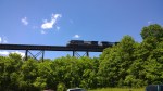
While there are several minor attractions and overlooks the remainder of the GW is just a smooth tree lined ride…..until it ends on I495 exit 14!  The GW basically throws you out on 5 lanes of beltway traffic that is normally bumper to bumper at any time of day.

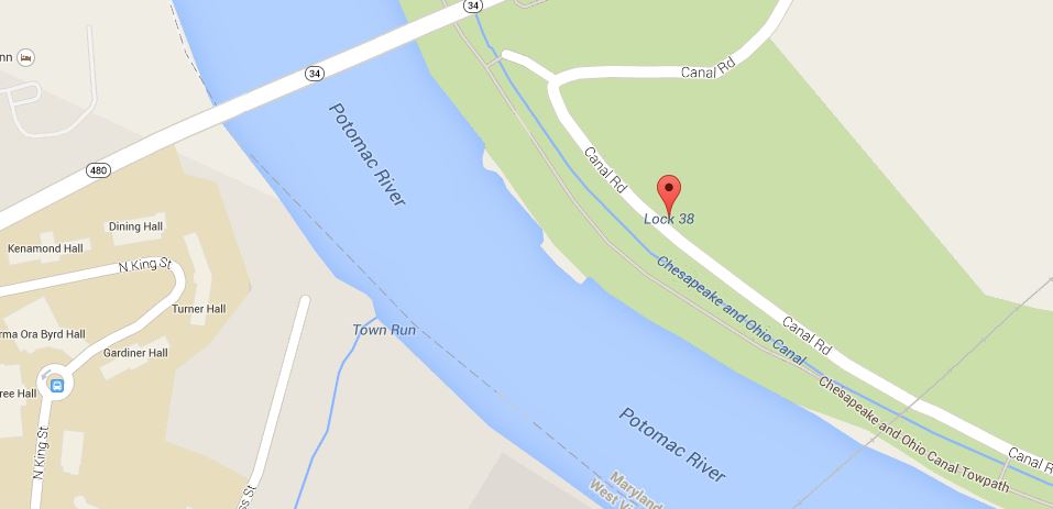
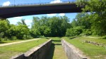
Luckily our route leaves us in the right hand lane and exits within a ½ mile onto the Clara Barton Parkway. We normally turn left and continue to follow the river upstream but there is good reason to head down river and visit the home of Clara Barton (founder of the Red Cross) and take in parts of the Chesapeake & Ohio Canal.

Debbie at the Old Angler's Inn

Debbie at the Old Angler’s Inn

Rolling past the US Nave Surface Warfare the parkway soon ends and we decided to have a light lunch at the Old Anglers Inn.  The Inn is Zaggat rated and the service was spectacular!

Old Angler's Inn

Old Angler’s Inn

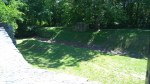
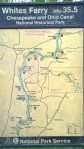
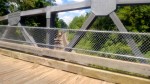
After our meal we followed several different roads ending up at White’s Ferry.  White’s Ferry is the only ferry currently operating on the Potomac River, having started in the early 1800’s.  One of the interesting parts to note about the ferry is how deep the flood waters have been over the years. With different flood stages marked on the building, it is remarkable sight to realize you are a dozen or more feet below the surface!

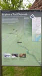
Taking the Ferry across the Potomac to VA puts us about four miles from home and is a fun way to cap this ride. As we were nearing home I got an idea for another ride…tracing the route of the C&O Canal, maybe we will be able to slip this one in sometime in the near future.