A few weeks ago, just before the temperature dropped (and pretty much stayed) into the 30s (F), I was able to get a late afternoon ride to the Bunswick stop on the C&O. For background on what I am doing with the C&O please look at this post.
Location – Brunswick Visitors Center 40 West Potomac Street, Brunswick, MD 21716
Mile Marker – 55
Historical Comments –This is all about the history of the C&O Canal.
The visitor center, which is shared with the Brunswick Railroad Museum, has several static displays regarding the canal (in classic National Park Service style), its development and its relation to the town of Brunswick.
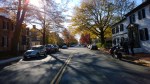
Ride to Site – The Visitors Center is located in downtown Brunswick. There is no actual “stop” on the canal.
Amenities – All normal urban amenities are present.
Road Conditions (from main road) – Normal two lane roads.
Railway Situation – If you attempt to ride to the path (not really accessible via your bike) the rail line is on the surface.
Parking Lot Conditions – Typical parking for a small town.
Main Attraction –
My Thoughts – Nice little museum. Brunswick, MD would make a nice little day trip from Washington DC or the surrounding area. Nice country roads will get you into town from any direction.
Map


-

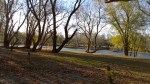
- View of the Brunswick rail yard